Mount Ontake is the second highest volcano in Japan (3,067 m) after Mount Fuji (3,776 m). The mountain repeated numerous eruptions for over sixty thousands years forming extensive caldera volcano. As we walked the trail from Kengamine peak to Mamakodake peak in two days, we could enjoy diversified landscape surrounding five craters. Each crater is called as pond. We stayed at Gonoike-goya which literary means 5th pond’s hut.
木曽の御嶽山は、言わずと知れた活火山だ。しかも標高は 3067 メートル。火山としては富士山に次いで日本で第二位の高さを持つ。数万年にわたって噴火を繰り返したため、山頂は広大なカルデラを形成し、変化に富んだ景観を楽しめる。五つの噴火口はそれぞれ、一の池から五の池までの名前で親しまれている。今回は五の池小屋に一泊してゆっくり池巡りを堪能した。
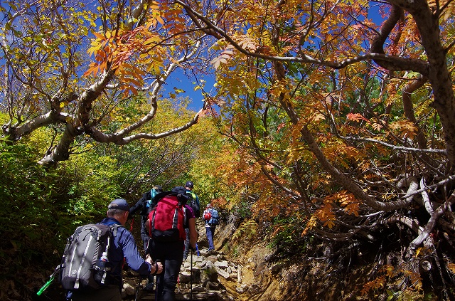
Walking under a Nanakamado tree.
色付き始めたナナカマドの下を歩く。
Ishimuro Sanso, where we’ll have lunch.
昼食を予定している石室山荘が見えてきた。
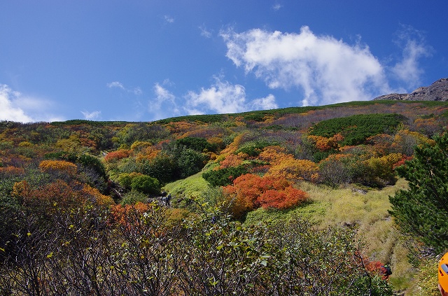
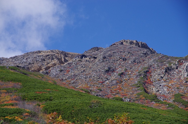
Nice contrast of green (creeping pine) and colored leaves.
この辺りはハイマツの緑と色づいた低木のコントラストが美しい。
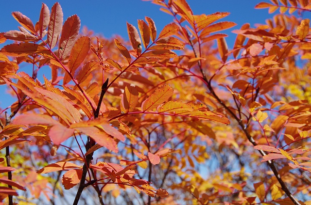
Nanakamado (Japanese rowan)
ナナカマドもあと少しで真っ赤になりそう。
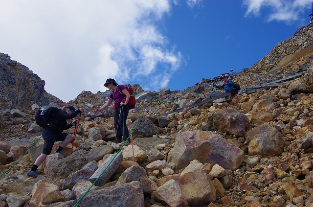
Reaching to Ishimuro Sanso
石室山荘のすぐ下。
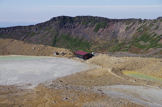
2nd pond and mountain hut. The pond, is now full of volcanic ash, used to have much larger surface and settled snow all seasons before the 2014 eruption.
二の池と二の池山荘。2014年の噴火の前までは大きくてきれいな池だった。湖畔には万年雪があったのだがそれも消滅。池は火山灰と粉塵で半ば埋まっている。
You may see the little bit of 3rd pond and the edge of 4th pond at the distance.
中央に見える丘の向こう側が三の池。池の隅っこがわずかに見えている。そこからさらに遠方に見えている窪地が四の池。
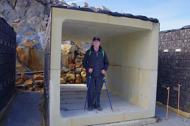
Protective shelter for volcanic eruption.
噴火に備えて設置されたシェルター。
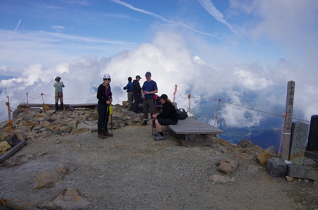
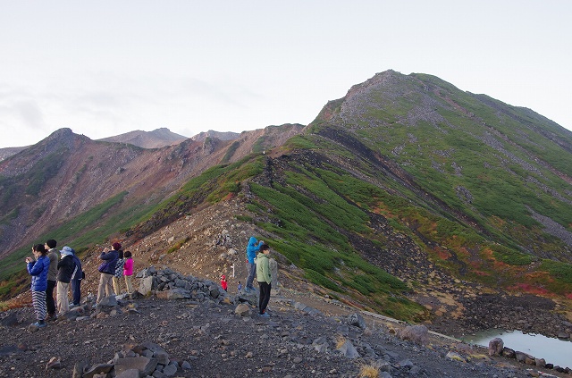
Terrace at the highest peak (3,067 m)
頂上(3067m)の展望テラス。
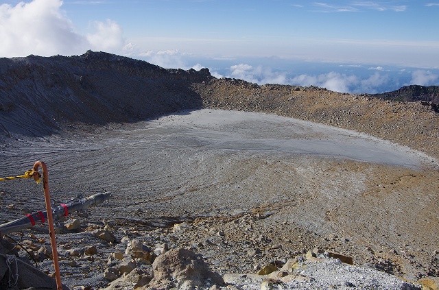
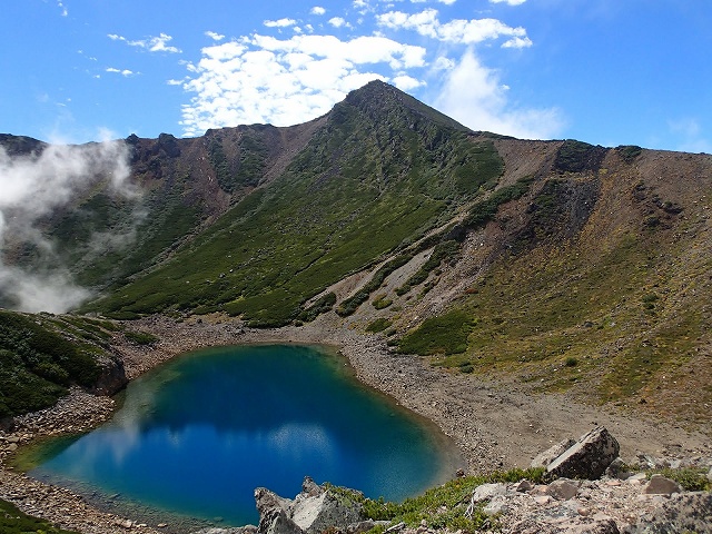
The 1st pond. I used to go round the edge of this crater befor the 2014 eruption.
テラスから見られる一の池。2014年の噴火前は噴火口の縁を歩いて一周することができた。
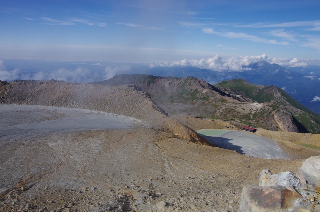
Standing at the Kengamine peak which located at the north part of Mount Ontake, you can overlook long perspective of the volcato. The pond nearest to this side is 1st pond and the one far in the back is Mamakodake peak.
剣が峰(頂上)からは御嶽山のほぼ全貌を見ることができる。手前から奥に向かって、一の池、二の池、賽の河原、摩利支天、四の池、継子岳。
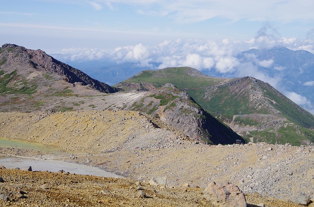
Now, we are viewing from the opposite side of volcano. Little water on lower right is 5th pond and the peak at far distance is Kengamine.
上の写真とは正反対に、五の池(画面右下隅の小さな池)から剣が峰方面を臨む。一番遠くに見えているのが剣が峰。右前方に高くそびえるのが摩利支天山。
3rd pond vewing from 4th pond. I did not have time to take a photo from this angle. The image is from “Jotenki” inn website at Kaida area.
今回は時間が無くて行けなかった四の池から見た三の池。(画像クレジット:開田高原のペンション LODGE 上天気)
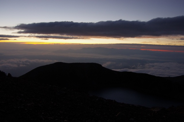
Before dawn. You can see the 3rd pond in the dark.
夜明け前の空にわずかに照らされた三の池。
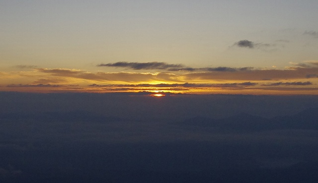
The moment of sunrise, 5:48.
ご来光の瞬間。
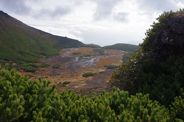
Creeping pine and 4th pond.
ハイマツの向こうに四の池を臨む。